Mga Pahina

Showing posts with label Pinatubo. Show all posts

May 19, 2012

Inside Mt. Pinatubo: The Crater Lake


Fast Facts:

Mount. Pinatubo is an active stratovolcano located on the island of Luzon, near the tripoint of Philippine provinces of Zambales, Tarlac, and Pampanga. It is located in the Cabusilan Mountains separating the west coast of Luzon from central plains. Before the volcanic activities of 1991, its eruptive history was unknown to most people. It was heavily eroded, inconspicuous and obscured from view. It was covered with dense forest which supported a population of several thousand indigenous people, the Aetas, who fled to the mountains during the Spanish conquest of the Philippines.


Mount Pinatubo Crater


On June 15, 1991, the eruption of Mount Pinatubo beagan at 1:42 p.m. local time. TYhe eruption lasted for nine hours and caused numerous large earthquakes due to the collapse of the summit of Mount Pinatubo and the creation of a caldera. The caldera reduced the peak from 1745 meters (5725 feet) to 1485 meters (4872 feet) high is 2.5 kilometers (1.5 mile) in diameter. It was considered as the second largest volcanic eruption of the twentieth century. The largest volcanic eruption was the 1912 eruption of Katmai-Novarupta ( Alaska).


Lagalag Expedition:


It was my first time to visit this one of a kind wonder of nature. Talaga namang excited na excited ako sa araw na ito. Mula sa paghahanda, pagpaplano at pag-aaya sa mga fb friends ko ginawa ko para lang matuloy ang Mount Pinatubo expedition. At hindi naman ako nabigo dahil sa mga taong sumuporta sa aking mga adhikain. aha!
It was a very wonderful morning when we arrived at Brgy. Sta Juliana, Capas, Tarlac where the tourism office located. Hindi ganun kadali puntahan yung lugar lalo na kung mag-cocommute ka lang. Magastos at higit sa lahat hassle talaga ang mag-byahe ng maaga lalo na at hindi ka pa talaga nakakapunta dun kahit minsan. We were very thankful dahil one of our friend, Edson, brought his own vehicle kaya di kami nahirapan. Yun ang kagandahan kapag may sarili kang sasakyan, hawak mo ang oras mo at madali kang makakarating sa lugar na pupuntahan mo. Early bird catches the early worms ika nga. Pagdating namin sa tourism office marami ng tao, tulad namin mga travelers din sila na gustong makaakyat sa Mount Pinatubo. Pero syempre hindi rin maiiwasan ang paminsan minsang hindi pagkaka-unawaan. And I think the local government of Tarlac should make an action on this issues. Marami ang may gustong pumunta ng Pinatubo kaya minsan nag-kakakulangan ng mga sasakyan. 


Scene every Morning at the Tourism Office

Charlie, Tan-tan and Richard.

Umagang sobrang dami ng tao. Weekend kasi kaya siguro ganun na lang kadami ang mga taong dumating galing sa iba't ibang bahagi ng Pilipinas. We were very lucky on that day because we didn't experience too much delay. Bago pa kasi kami umakyat inayos na namin lahat pati yung sasakyan namin na 4X4. A group of ten person, saktong sakto sa dalawang 4X4 na pinareserved namin. So after registration at konting pahinga sa jumpoff point, nag-umpisa na kami sa aming paglalakbay.


Check  Point

I want to be a mountain climber!!! ho!ho!ho! Morning exercise ng Philippine army habang nag-jojoging sa kahabaan ng kalsada ng Brgy. Sta Juliana. Puno ng energy, parang kami puno ng battery charge sa katawan at ready na sa darating na pagsubok.


The Pinatubo way...

This is where our journey begins. Pagkatapos dumaan sa isang check point, bumungad sa amin ang isang malawak na kapatagan na dating dinaanan ng rumaragasang lahar. hmmm... 


This is how Pinatubo change this part of  Tarlac.

Isang maalikabok at bako bakong daan ang babati sa lahat ng bisitang pumupunta sa Mount Pinatubo. Halos 1 hour ang travelling time na ginugol namin bago makasapit sa next jumpoff point. Kung saan wala ng sasakyan na mag-hahatid sa amin. Dahil pagdating doon, lakaran to the max na ang aming gagawin. 


The road going to the next jump-off point was really exciting. Lalo na pag-may mga humps at tuwing nag-splash ang tubig sa paligid. And of course, the marks of lahar and landslide sa buong paligid ay talaga naman nakakamanghang pag-masdan.


Stop Over!


Our first group picture along the way and my first solo pix. From left: Jerico, Jeffer, Charlie, Joanne, Bryan, Batangkapampangan(Me), Edson, Charlene, Jonathan and Richard.

The Fast and the Furious???

After that mala-roller coaster ride sa loob ng isa at kalahating oras, finally we had reached the next jump-off point. From here, we need to walk for almost 2 hours and it depends on your pacing. Syempre para sa mga sanay na maglakad ng ganun katagal hindi na yun ganun kahirap.

Parking lot for 4X4s...
From here, we started to walk for almost 2hours. 


The weather was so nice on that day. Hindi ganun kainit dahil sa mga ulap na tumatabing sa aming nilalakaran laban sa matinding sikat ng araw. Wow! parang sa bible yun ah? 


Lakad lang ng lakad. Parang walang katapusang paglalakad. What I liked about this hiked was the amazing view that captured everyone's attention in every angle of the trail. Isang mahabang lakaran sa gitna ng mga gumuhong bundok at mga lahar.


The trail going to the crater is very manageable. Hindi naman kailangan ng matinding effort. Para ka nga lang naglalakad sa kalsadang hindi sementado. There were lots of huge boulders around. And during rainy season, water from the mountains flows in this area. Kung kaya minsan ipinagbabawal ang pagpunta dito tuwing masama ang panahon.


Is that a house? Nope, it is a cottage where everyone can stop for awhile and have some rest. There is a comfort room at the side and a water source that can be drink. 


Another group picture. Sa kabila ng pagod at gutom, kaya pa rin nating ngumiti. And that's the Spirit! 


This is it! hmmmm... Your time record on reaching the crater will tell you how old you really are. huh! E paano kung lumampas ako ng twenty minutes? Hindi ba pwedeng tumawad? ehehehe


Take Nothing but Pictures lang daw...

Warning: Don't try this at Home... tsk! tsk! tsk! Jeff, wala ng aabutan ang susunod na henerasyon. Sira mo na eh....


After a minutes of rest, we continue our trek going to the crater lake. But on this time, malakas na ulit kami at game na ulit sa paglalakad.

Signages Along the Way:


These signage reminds everyone to be extra careful since the trail is becoming narrow and stiff in this area.

Almost there...

The gigantic caldera of Mt. Pinatubo.

Finally, we had reached the crater. Congratulations!!!!


This was the most challenging part of Mt. Pinatubo, the descent and ascent. Dahil sa matarik na hagdan pababa, medyo sumakit ang mga binti namin.

Pagdating na pagdating pa lang ng grupo deretso lunch agad. And after that we decided to rent a boat that brought us to the hot spring. Ibang iba talaga ang kulay ng tubig sa crater na lalong nag-papaganda sa paligid. The natural landscapes of Mt. Pinatubo was truly an awesome sight to behold. 

After the eruption in 1991, ganito na sya kaganda ngayon...


Pero dahil sa contaminated ng sulfur ang tubig, walang mga isda ang nabubuhay sa lawang ito.


As in hot talaga. May part na talaga namang mainit at hindi ko matagalan.


Hot spring

Ang mga taong putik. Those are volcanic mud, dahil sa curiosity nakigaya na rin kami sa mga taong nandun. Di ko alam kung anong epekto nito sa balat basta pahid lang ng pahid. Enjoy naman eh. ehehe!


After an hour and a half na pagtatampisaw at paglalaro, nag-banlaw na kami at bumalik na sa kabilang side ng crater.


The Crater Lake

At syempre, bago umuwi kailangan ko rin ma-experience ang pagsasagwan. Sa una akala ko madali lang, hindi pala...

Ang Bangkerong Kalbo...
Feeling naman...ehehe!
Pag-hahanda sa pagbaba... 


Isa na namang araw ng pag-lalagalag ang lumipas sa buhay ng batang kapampangan. Isang araw sa Mt. Pinatubo ang muling daragdag sa aking mga paglalakbay. Hanggang sa mga susunod pang pag-lalagalag. Drama mo!!!! ehehehe! Sa uulitin....


Lagalag Reminders:

Take Nothing but Pictures, Leave Nothing but Footprints, Kill Nothing but Time

Photos courtesy of Jerico Urbano and Batangkapampangan

March 12, 2012

Miyamit Falls: It's More Fun in Porac


Fast Facts:


Porac is a 1st class municipality and considered as the largest town in the province of Pampanga, Philippines. Porac has a Hilly to Mountainous Terrain on majority of its plains. This town was one of the most affected when Mt. Pinatubo erupted on June 12,1991. After so many years, the town of  Porac is now moving forward. Could anyone thought that in this town you will find a high and enchanting falls, The Miyamit Falls.


First Thing to do:

The day before my adventure, I went first to the Mayor's office at the Municipality of Porac located at Brgy. Poblacion, for registration. I signed a waiver and they gave me some instructions to ensure my safety for this solo trip. Mabuti na yung nasa ayos.

How to get there:

From Cubao or any part of Metro Manila take a bus ride going to Mabalacat, Pampanga, buses going to Northern Luzon usually do a stopover at Mabalacat Bus Terminal. From Mabalacat take a jeepney ride going to Angeles City, Porac jeepney terminal is located near Sandra Mall. For first timer, just ask the driver and they will tell you the way. The jeep are available 24hours a day, depende na lang sa dami ng mga pasahero sa mga oras na alanganin. Minsan kailangan pang mag-hintay or magdagdag ng bayad sa pamasahe para sa isang sulong. Tell the driver to drop you by at Brgy. Dolores. From there you can hire a tricycle from Brgy. Dolores, Porac or take a private vehicle going to Brgy. Sapang Uwak. The fare cost P200, medyo may kamahalan para sa nagsosolong tulad ko. At dahil masyado pang maaga at may kalayuan din ang Sapang Uwak, it is advisable to have a guide or a friend who are knowledgeable of the area.

Meet Up Time: 5:30 am


Goodmorning Pampanga!!!
At Exactly 5:20 am when I arrived at Brgy. Sapang Uwak. The Brgy. Captain was already there waiting for me together with Nog, my guide. Bago pa man ako pumunta tinawagan ko na si kapitan, to inform him about my trip to Miyamit. Sya na rin ang nag-hanap ng magiging guide ko sa araw na yun. At around 5:30 am we decided to start our trip. Magkahalong kaba at excitement ang naramdaman ko nung araw na yun. Kaba, dahil hindi ako familiar sa lugar at medyo madilim pa ang paligid. Excitement, dahil na rin siguro sa kagustuhan kong makita ang sinasabi nilang nakatagong ganda sa bahaging ito ng Porac.


Pinoy Explorer? malapit na ba?

First hundred steps, ok pa ako.The next hundred steps uphill climb, my heart beats faster and faster, my legs starts complaining. May mga pagkakataon ngang na-iisip ko kung pwede pa bang magback- out? Para kasing napasubo yata ako sa lakad kong ito. Pero dahil sa gusto kong maging isang certified lagalag, kailangan kong panindigan ang mga nasimulan ko. aha! 


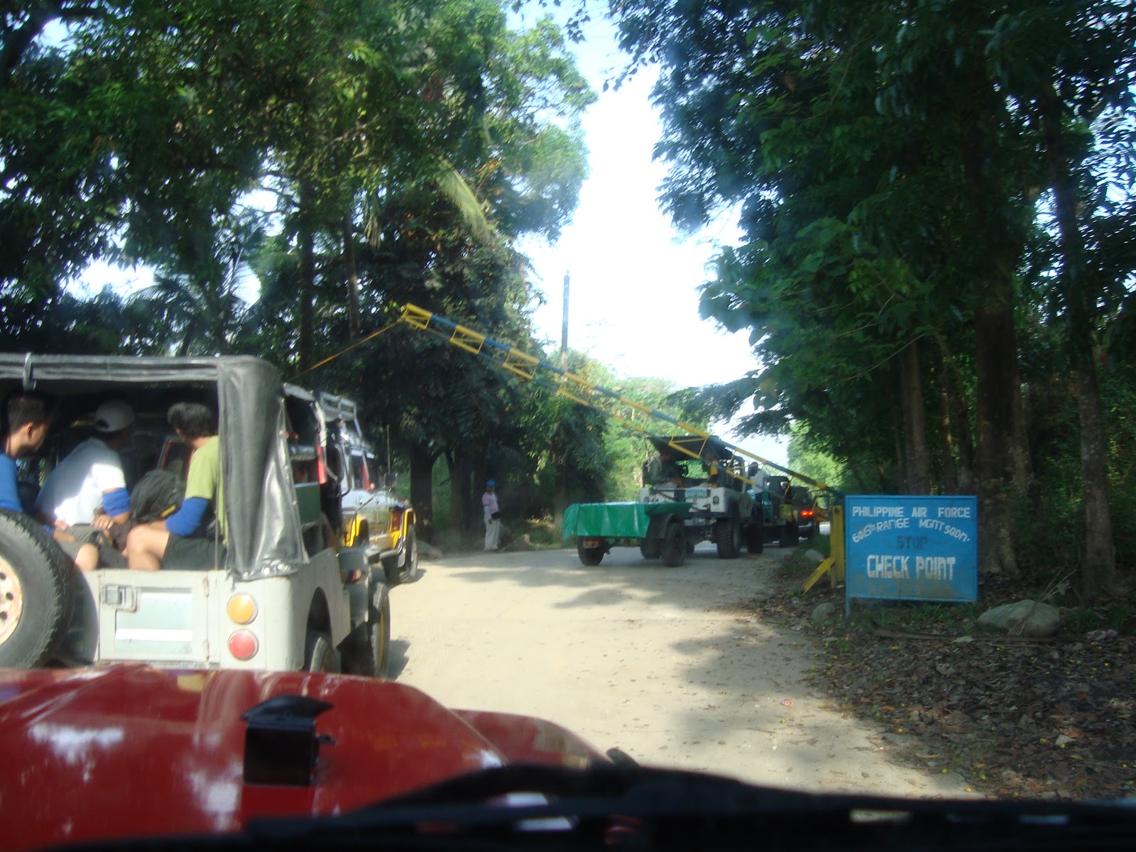
I mean it, the trail was not that easy as I thought. Everytime we encountered a long and intimadating uphills I asked my guide"Last na ba to?" and he smiled sabay sabing marami pa dun."patay tayo dyan!" Hindi naman mahirap sundan ang daan, wala ka ngang kaligaw eh. Yun nga lang may mga bahagi na pataas na parang wala nang katapusan. Thanks to Nog, dahil may mga pagkakataon na sya ang bumubuhat ng gamit ko.


The Floating Mt. Arayat...

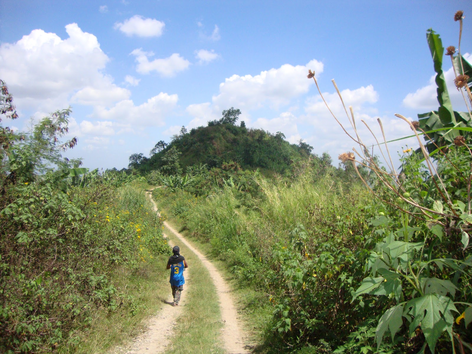
When we were walking, I've noticed that a light strikes at my back. Sa una hindi ko pansin, pero habang tumatagal unti-unting lumiliwanag. And when I looked behind my back, boom! Wow! Abak na! The sun starts to rise. Abot tanaw ng aking mga mata ang napakagandang tanawin ng bundok Arayat. Along the way you may see these beautiful wild sunflowers.

Bulaklak ng Kalabasa???

After that Mt. Pinatubo eruption, parang walang bakas ng pagkawasak ang buong paligid. It leaves no trace ika nga. What a nice and amazing place, with cool morning breeze and unique landscapes of nature made my trip worth it. Once in a while I paused for a break and took some pictures. At habang naglalakad panay ang kwentuhan namin ni Nog para malibang at hindi mabagot.
Always keep that smile when there's a Camera

As we continue, we met some of the locals (Aetas) along the way doing their usual activities every morning. A simple smile from them makes me feel at home. Halos lahat nga yata ng mga taong makasalubong namin kakilala ni Nog. Kaya mas lalo akong naging kampante. The place was so quiet and peaceful. Mga huni lang ng mga ibon ang madalas mong maririnig sa paligid.


Malapit na...

From where I'm standing, I can see the gazebo (the View Deck). Parang ang lapit na lang nya, pero sa totoo malayo pa. huh! I told Nog to joined me in some of my pictures. At dahil sa haba ng aming paglalakad nakuha ko rin ang loob nya. Malaki talagang tulong pag may dala ka ring tripod. Nog was a very cool guy. We both like picture takings, kaya siguro madali nyang nasasakyan mga trip ko. Ehehe!


Pwede naman siguro magpahinga muna.


But before we went up to the summit, we took a minutes of rest at the junction point. Kailangan ko ng konting oras para makabawi ng lakas pagkatapos ng mahaba at nakakapagod na lakaran. In here, I prepared myself for the final leg to the summit. Since the way to the view deck was very narrow and steep, kailangan kong bumwelo ng kaunti.

Summit na rin sa wakas!

Finally, at exactly 8:02 am when we reached the summit. Whooooooh!  Napasigaw talaga ako.  Feeling ko tuloy ako si Garduce or si Kuya Kim... Whahaha! It was my first time to climb a mountain as high as this. Kaya para akong bata na tuwang tuwa.

Catch a Glimpse of Miyamit Falls

I can see the twin falls from the top. It was really enchanting. Mt. Negron on my left. Mt. Pinatubo was hiding at the clouds on my right. Right timing ang panahon, dahil sa ganda ng sikat ng araw mas lalong naging maaliwalas ang paligid. At dito ko masasabing sa taong masipag maglakad may ganito kagandang lugar na nag-hihintay. boom!


Japan! Japan sa View Deck!

Isang magandang tanawin ang makikita sa itaas ng bundok. Sa view deck marerelax ang katawang pinagod ng mahabang lakaran. Na lalo namang maiibsan ang gutom at pagka-uhaw kapag may meriendang pagsasaluhan. bow!


Merienda Time
The View Deck
After an hour of  picture taking and chatting with Nog, we have decided to continue our journey going to the falls. It will take almost or more than an hour for you to get there,  yan ay depende sa Bilis mo maglakad.

Banana Mountain...


The trail going to the falls traverses several kilometers over a few steep mountain trails. As you go closer to the mountain you will notice  these banana trees instead of hard towering trees growing along the area. Almost 80% of this mountain was covered by banana. 

At exactly 9:27 am, we arrived at Miyamit falls. At first there were series of mini water falls along the way and at the end of it, we were surprised by these two water falls which I think, approximately 30 to 35 feet high.

The Miyamit Falls
The sounds of the falling water was like a music passing through my ears. Parang panaginip nga eh, but it was real.

The water was so cold and clear. It was not as high as Maria Cristina Falls, but the elegance of the twin falls brings satisfaction to those who want to see it upclose. Sulit talaga ang pagod sa paglalakad pagsapit mo sa lugar na ito.

Bahay Kubo, kahit munti...
If you're worried about where to stay when you get here, don't worry my friend there are lots of bahay kubo around to choose from. Pero kung gusto mo naman ng mas malapit sa falls, pwede rin ang mga malalaking bato sa paligid.

Is it True or Falls?
My camera was in position. Picture dito, Picture doon. This was really the highlight of my adventure and I highly suggest that everyone should visit this falls. For those people who seek adventure and want to experience a one of a kind nature trip put Miyamit falls in your list.  

Sarap maligo...
Since I'm the only visitor in this place on that time, with my guide of course, I took the opportunity to feel the coldness of the water. Liguan na! 

It's time to go Home...
At around 11:30 am we decided to leaved the place. Medyo bitin nga lang pero dahil may lakad pa ako kaya kailangan ko rin kaagad umuwi.  We reached Brgy. Sapang Uwak at around 2:30 am. Pagdating sa baryo sabik na sabik ako sa malamig na inumin. And while waiting  for my service, bonding moment muna sa mga kabataang Aeta. It was really a very nice experienced. Isang araw na naman ng pag-lagalag ang natapos sa buhay ni Batang Kapampangan. Karanasang nakatatak na sa aking puso at isipan. Karanasan na isang Certified Lagalag.
Sa Uulitin 

My Itinerary: Day Trek

0410H Mabalacat Bus terminal,take a jeepney via Angeles ( P8-P10)
0425H ETA Porac Jeepney Terminal @ Angeles City ( P18)
0445H ETA Hacienda Dolores Terminal take a tricycle via Sapang Uwak (P200) Plus waiting time.
0520H ETA Jump off Point at Sapang Uwak
0530H Departure
0800H ETA At the View Deck(Snack)
0845H Departure ( next point The Miyamit Falls)
0927H ETA at The Miyamit Falls(snack)
1130H Departure
1430H ETA  Sapang Uwak (Aeta Community)
1450H ETA Jeepney Terminal going to Angeles City

Fee for guide not included (Php500)
Please contact the local Government of Sapang Uwak

Bring Me:

Bring your own First Aid Kits and Emergency Equipment
Trekking poles
Light clothes.
Foods( easy to open canned goods, bread, biscuits etc.)
Water or Energy Drink.( in my case I bring 1liter Gatorade and
500ml of distilled water.) one way trip only.
Garbage bags
If you don't want to spend much money, bring your barkada with you. Para may kahati ka sa mga gastusin.
Lagalag Points of View:
My desire to learn more about my province and my country brought me here. I'm proud of my place and I wanna share it to all the people who drop by here in my site. I hope you enjoy it. Thank you...

Take Nothing but Pictures, Leave Nothing but Footprints, Kill Nothing but Time

Contact Us:

Address: Porac Municipal Hall, Poblacion Porac, Pampanga 2008

Trunk line no.: 045.329.3222